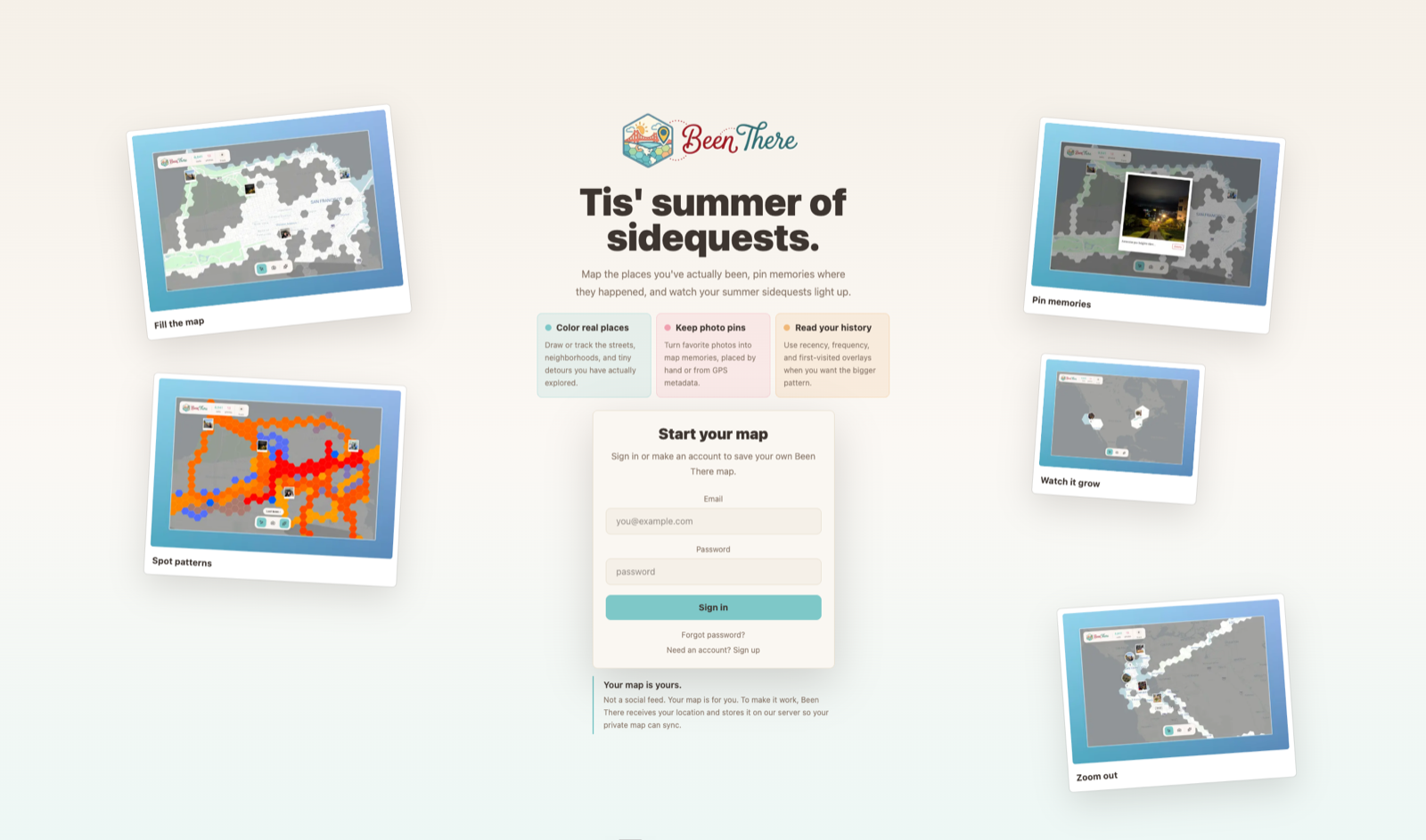
Been There is a map-memory app for filling out the places you have visited. You color in real-world areas, watch your explored map grow, and add Polaroid-style photo memories to the locations where they happened.
The app is live in the browser at been-there-maps.vercel.app, and the code is on GitHub. The native app is currently in limited preview while we keep working through the installable iOS/Android experience.
The landing experience frames the product as a summer sidequest: map real places, keep photo pins, and read your own history through the places you have actually explored.
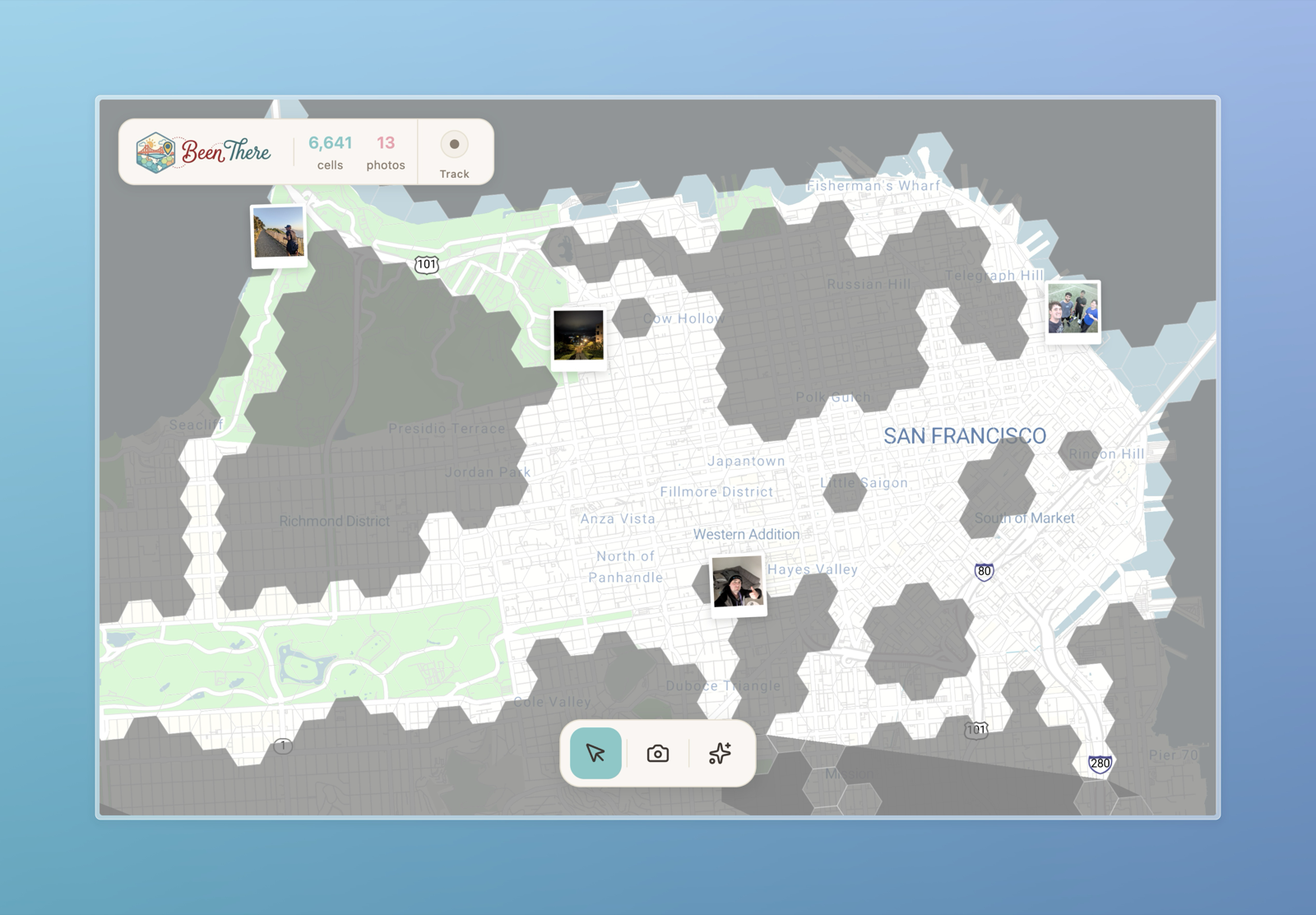
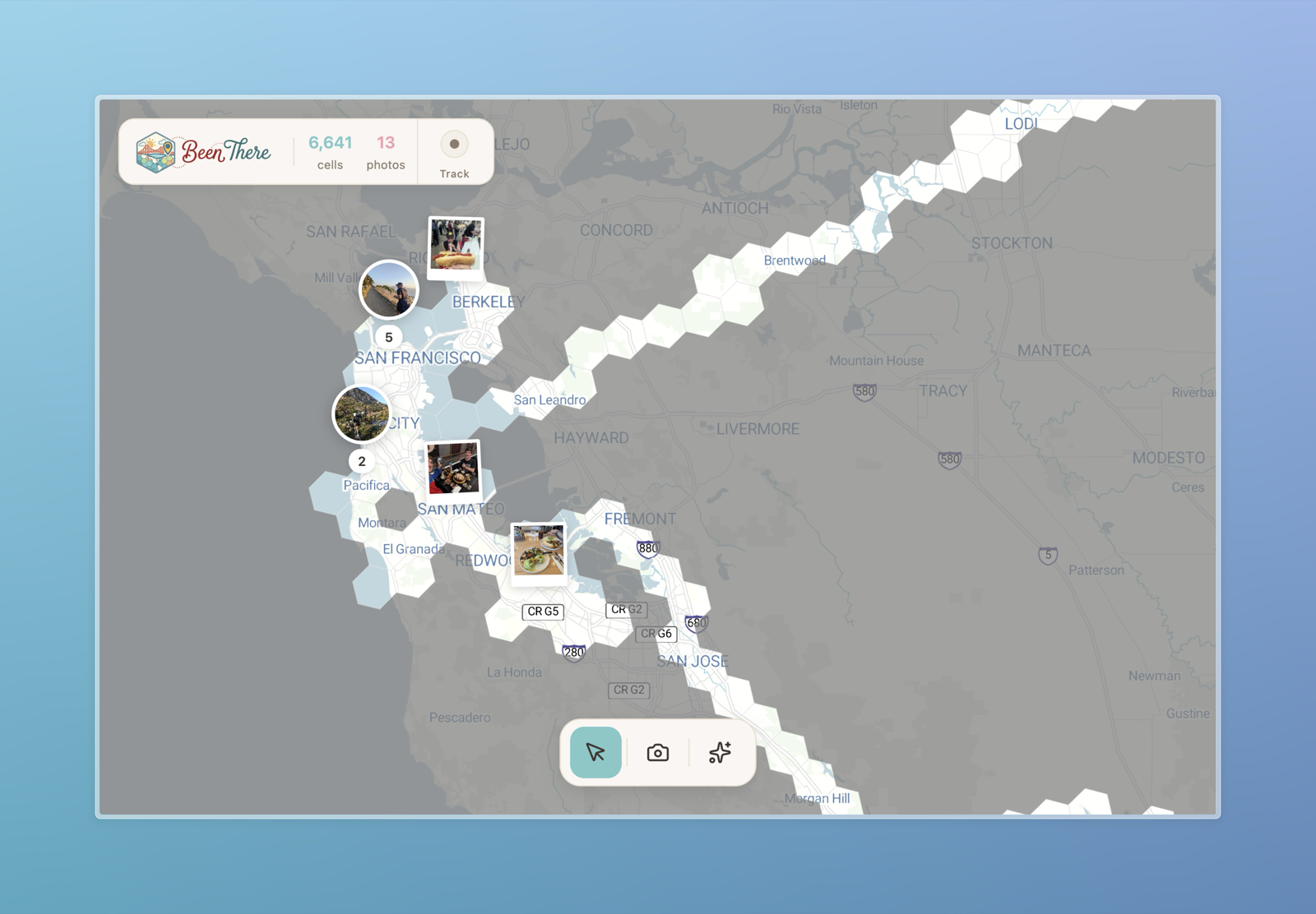
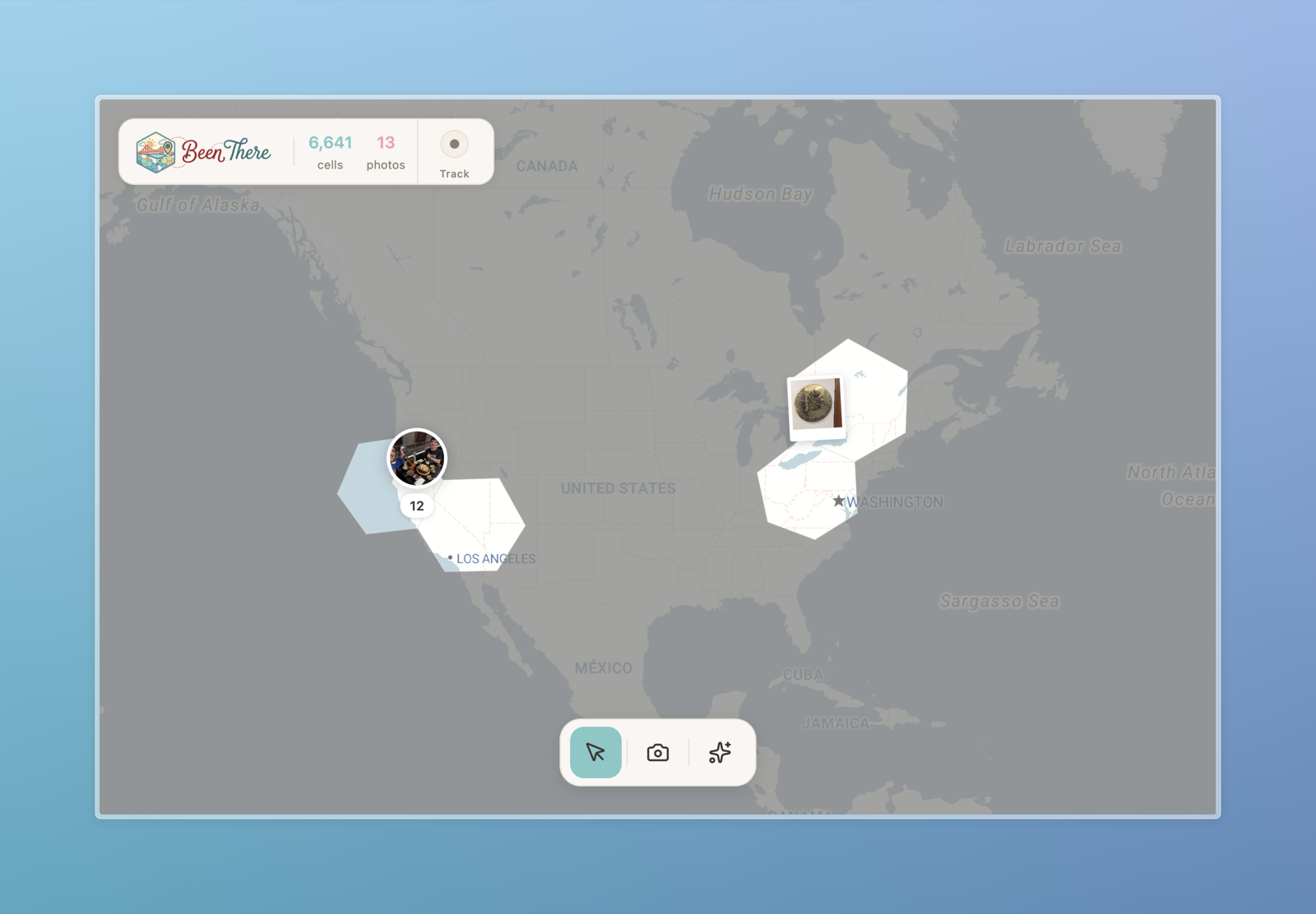
Under the hood, Been There uses Uber's H3 hexagonal spatial index to represent where you have been. It stores fine-grained visited cells and derives larger parent hexagons at lower zoom levels, which makes it feel good whether you are looking at a neighborhood, a city, or a whole continent.
One of my favorite pieces is Intelligence Mode. It turns the map into a heatmap-style layer, showing overlays like when you were last somewhere, where you have been most often, and when places were first visited.
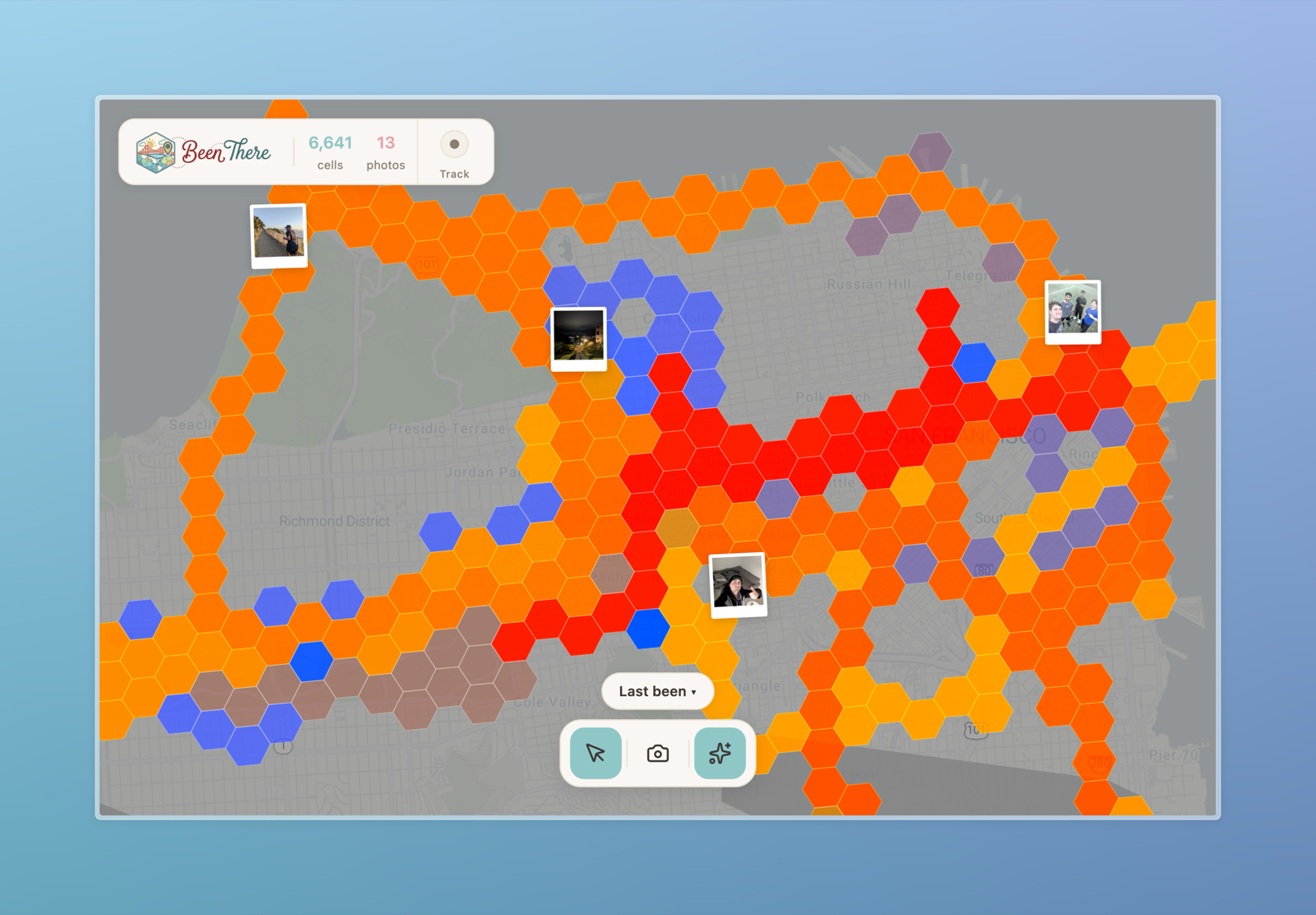
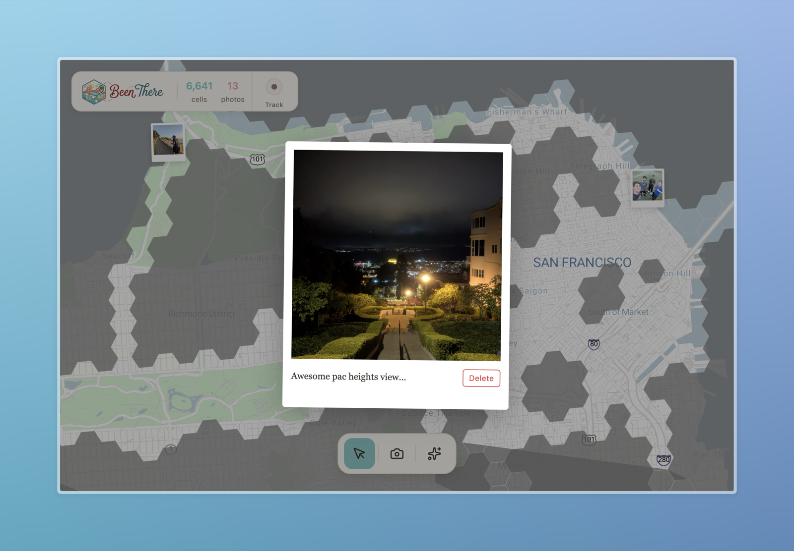
The app also supports photo pins. Photos can become little Polaroids on the map, and uploads with GPS metadata can place themselves automatically. It makes the map feel less like a tracker and more like a memory surface.
Technically, the project brings together Next.js, MapLibre, Stadia's OSM-based map tiles, Supabase, H3, EXIF parsing, Supercluster photo clustering, PWA support, and Capacitor work for Android/iOS. We also worked on background geolocation and native-app behavior so it can become more than a normal website while still being usable from any browser.
- H3 hexagonal mapping for visited places at multiple scales
- Intelligence Mode for recency, frequency, and first-visited overlays
- Polaroid photo pins with EXIF-aware location placement
- Open-source map rendering with MapLibre and OSM-based tiles
- Capacitor, PWA, and background-location work for an installable app experience
Try it at been-there-maps.vercel.app or read the code on GitHub.
Back